Richmond Jetty -- December 13, 2005
Purpose: To determine at what water level the Jetty fills with water, as in People's 100, and to capture another rising tide in case the water levels on December 5 were lower than predicted.
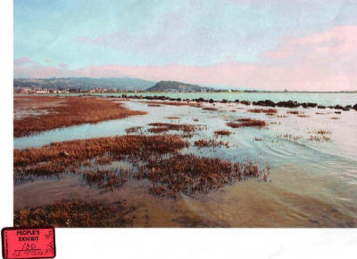
People's 100
Rick Distaso displayed People's 100 as evidence of how the Jetty fills with water at each high tide.
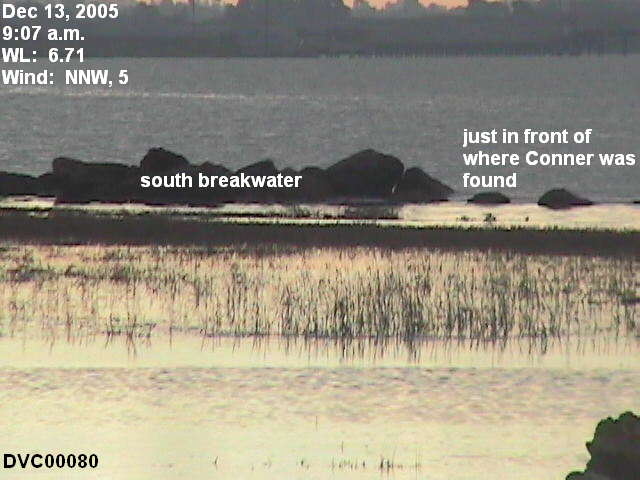
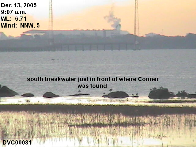
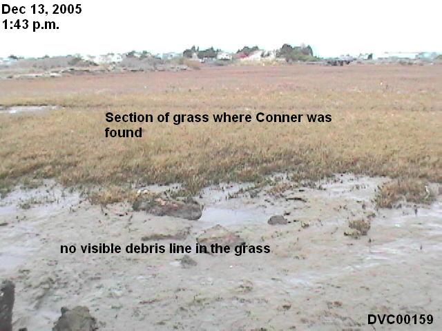
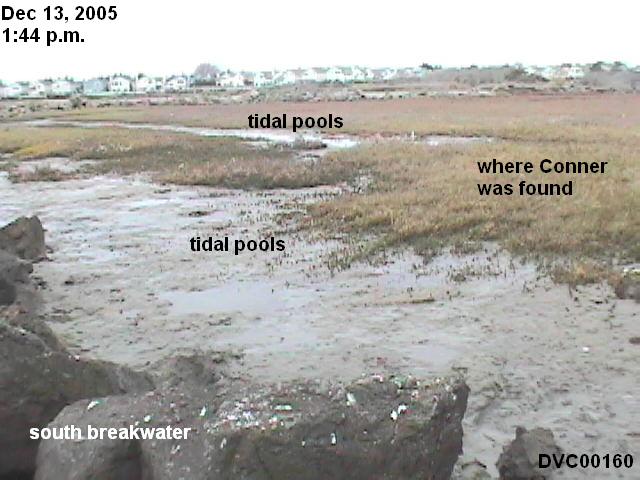
HARRIS: You can go ahead and have a seat. Now, at that particular location where Conner was found, when the tide comes in does that area fill with water?
SOLER: Yes, it does.
HARRIS: Like to show you what's been previously marked as People's 100. Do you recognize what's depicted in that photograph?
SOLER: Yes.
HARRIS: And is this the area that we're talking about?
SOLER: Yes, it is.
HARRIS: Does it accurately depict this area when the water is filling the marsh area?
SOLER: Yes.
Distaso did not provide the date and time this photograph was taken, so we can not verify the actual water level. The picture shows very little wave action, so we can safely assume the winds were calm.
According to the NOAA, the average of all high tides is 5.45 feet above MLLW. The field trip on December 5, 2003, proves without a doubt that the Jetty does not fill with water during a high tide that is 5.45 feet above MLLW. The high tide on December 5 peaked at 5.96.
The NOAA says that the average of all the higher high tides is 6.05 feet above MLLW, a little higher than the December 5 high tide. This field trip is tasked with showing whether a 6.05 foot tide will fill the Jetty with water.
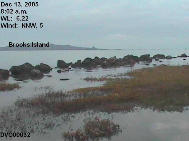
Actual water level
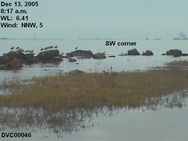
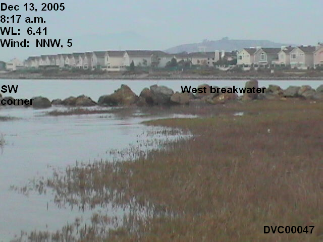
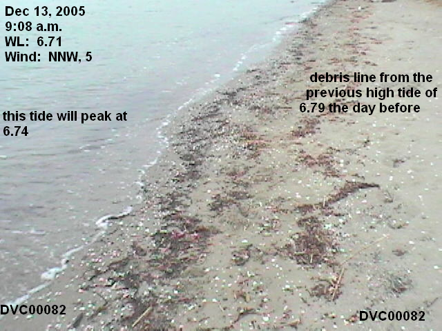
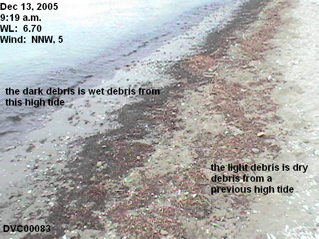
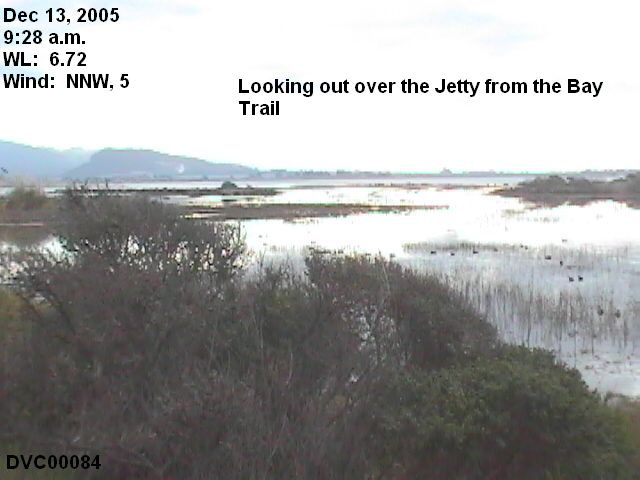
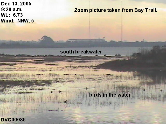
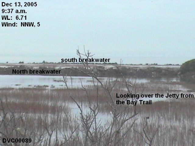
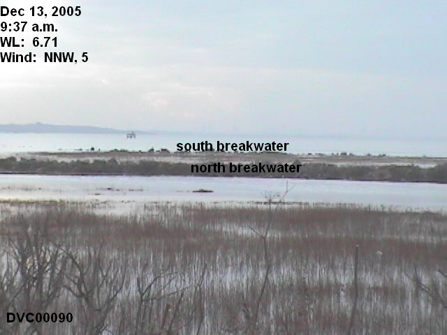
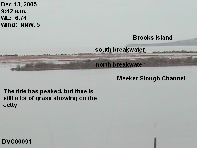
High tide was predicted to peak at 6.8 feet above MLLW at 9:30 a.m. Unfortunately, the 9414863 Richmond, Chevron Pier station was still out of order, so I had to compute verified water levels from the 9414290 San Francisco station. The San Francisco station is the reference used by the NOAA to make the predictions for the Richmond station, adding 24 minutes and multiplying by 1.04 for the high tides. The NOAA predicted a high tide of 6.59 feet for the San Francisco station. Verified water levels show the tide only reached 6.48 feet. That computes to a 6.74 foot actual water level for the Richmond station. See conversion chart.
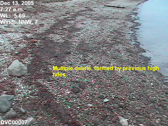
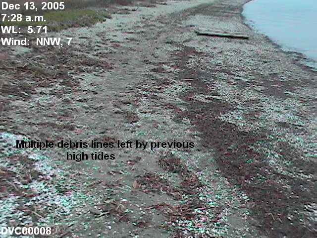
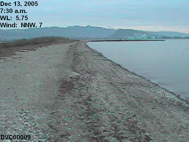
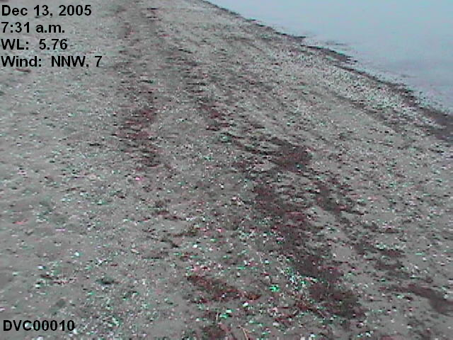
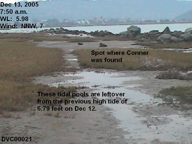
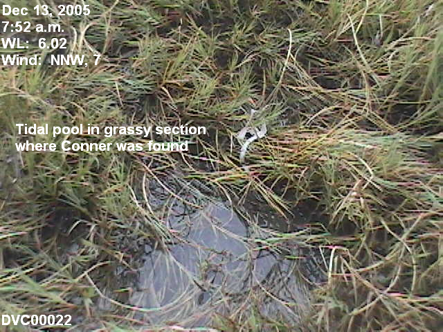
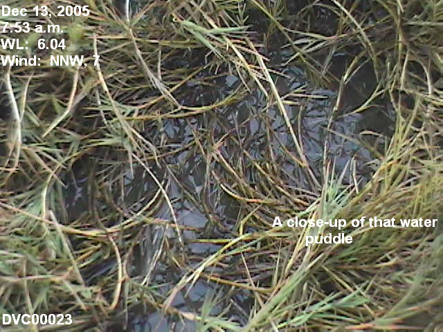
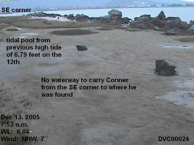
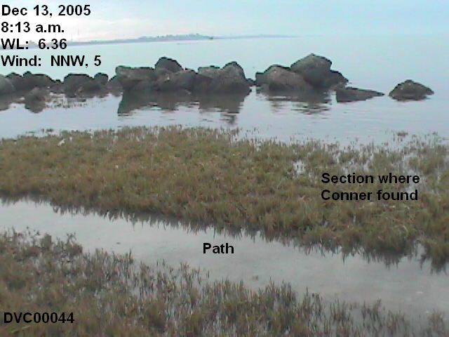
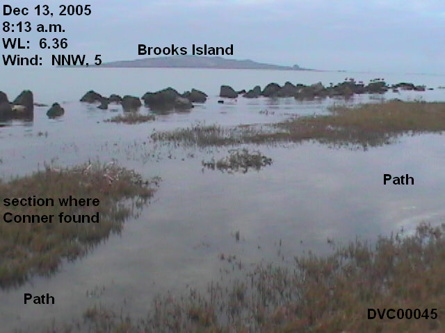
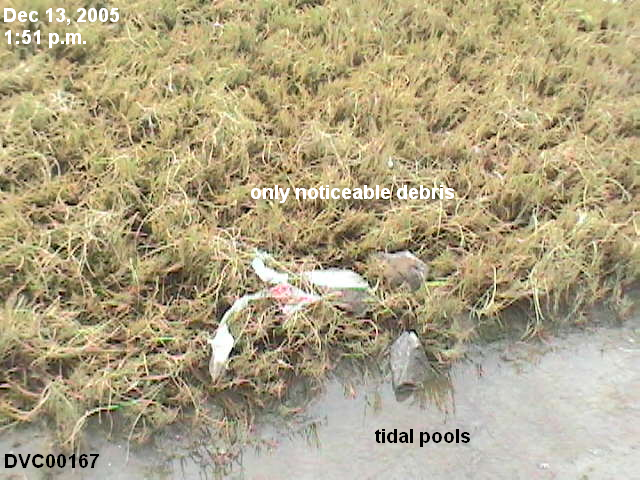
In the pictures, you will see tidal pools and debris lines from the previous high tides:
December 10: 6.31 feet
December 11: 6.58 feet
December 12: 6.79 feet
Wind Speed and Direction
Wind information isn't available from the 9414863 Richmond, Chevron Pier station. The UC Richmond station reports the following wind conditions (click here for wind direction degrees):
7 a.m., 7 mph, 346 degrees (NNW)
8 a.m., 5 mph, 342 degrees (NNW)
9 a.m., 5 mph, 334 degrees (NNW)
10 a.m., 5 mph, 308 degrees (NW)
The LA Times reports the following wind conditions for the Oakland Airport:
6:53 a.m., Calm
7:53 a.m., 5.8 mph, NW
8:53 a.m., Calm
9:53 a.m., 5.8 mph, NW
The Pictures and Videos
I took a total of 95 pictures and 12 video segments, and have grouped them by six-minute intervals, with the beginning and ending water level. Click on any thumbnail to enlarge. Each video clip is in two formats: Windows Media Player (WMP) and RealMedia (RM). You should use the RM version if you have dial-up, as they are smaller files. Click here to download a free RealMedia clone if you don't already have RealMedia.
Tip on viewing the videos. Full screen distorts the video. If the video opens at full screen, click the maximize button (to the left of the X exit button at the top right) to decrease the viewing size. You can further decrease the size by putting your cursor at one of the corners and dragging it in. The smaller the viewing area, the sharper the picture.
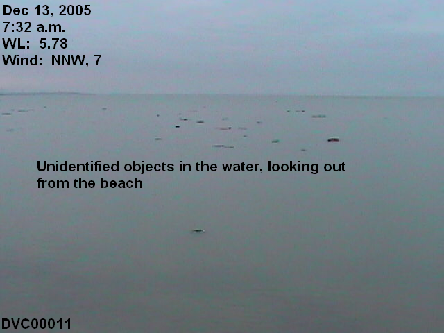
Video 1: WMP RM The beach Video 2: WMP RM Floating object
This video segment shows how the debris line forms by the waves pushing ahead. The pictures show the multiple debris lines left by previous high tides.
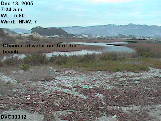
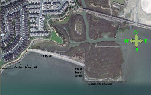
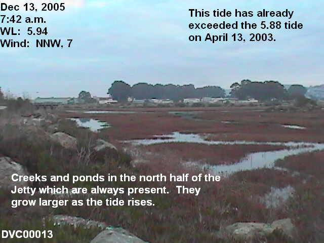
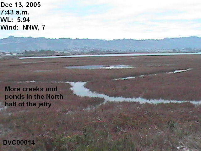
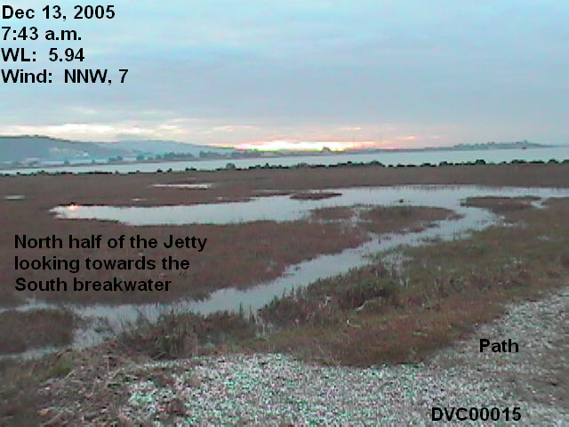
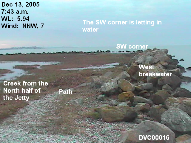
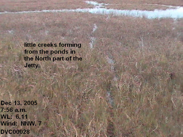
Video 3: WMP RM VWL: 5.85-5.95. I've included an aerial view of the Jetty that shows the ponds and creeks in the North part.
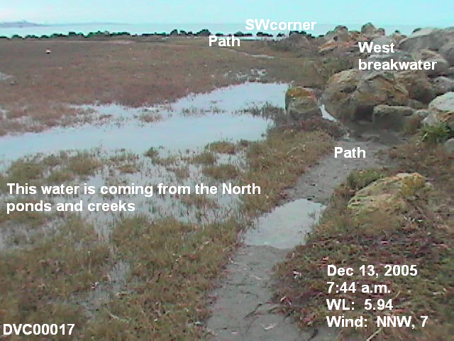
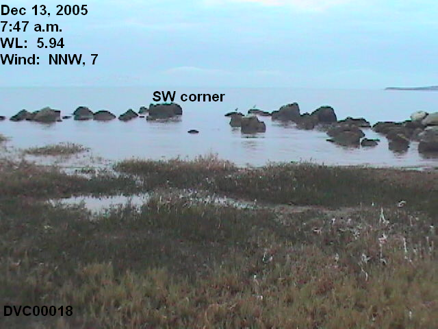
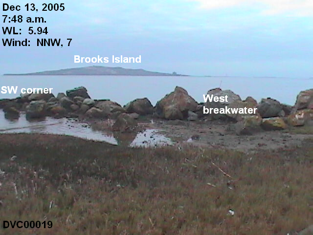
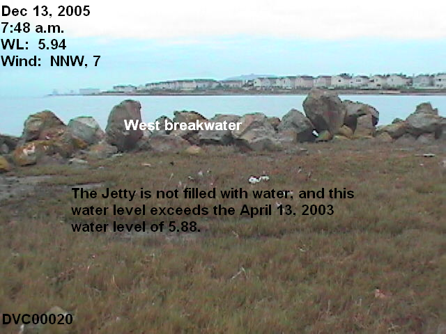
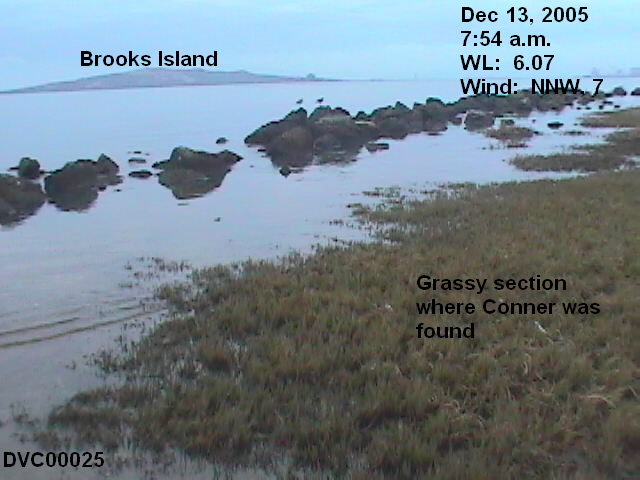
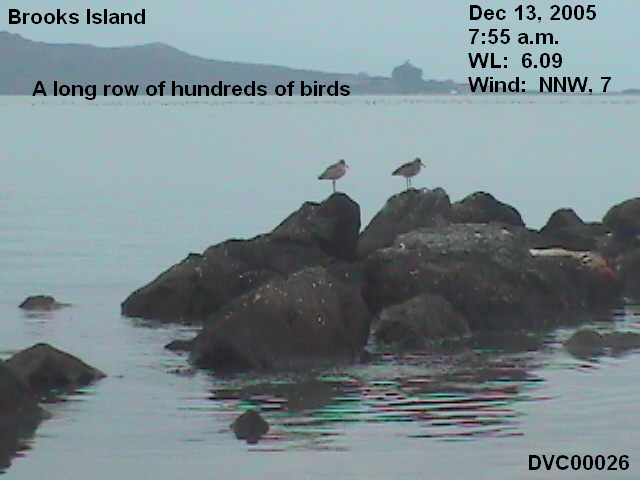
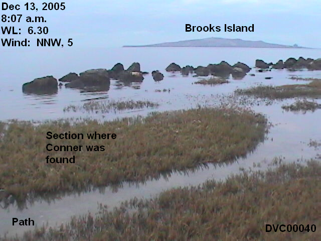
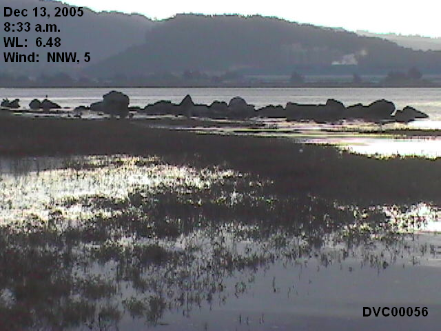
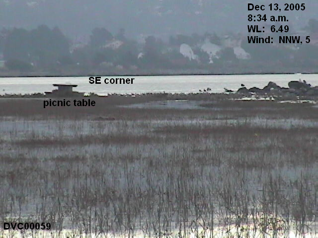
7:48-7:54, 5.94-6.07 feet. Video 4: WMP RM

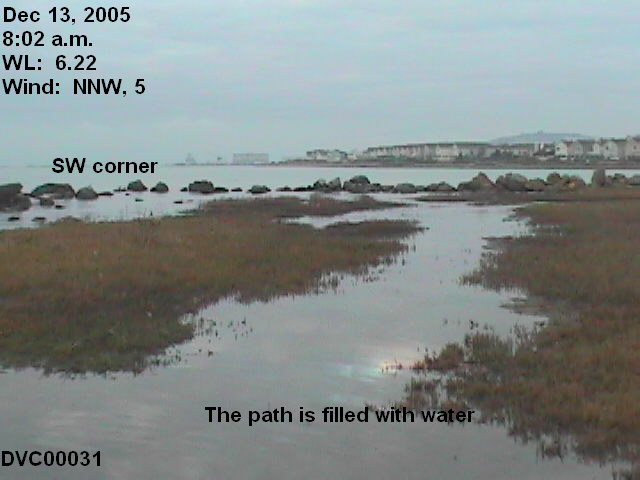
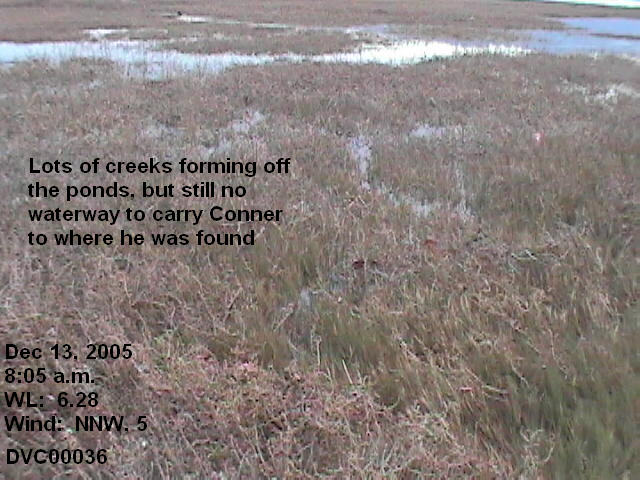
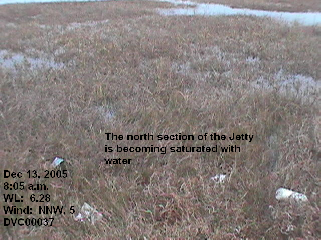
8:00-8:06, 6.18-6.29 feet. Video 5: WMP RM
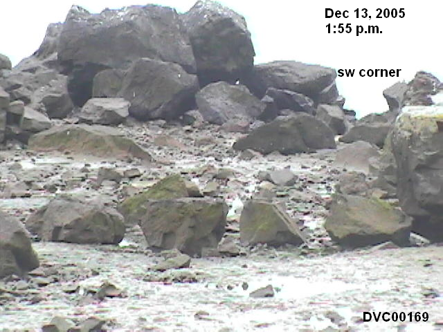
The video shows very well how the water wraps around the grassy area to come up to the path, and how the water comes from the SW corner to fill the path to the west of the Conner site. It also shows the gentle wave action. Stronger winds producing higher waves would put more water onto the Jetty, but strong winds are not an usual occurrence in this part of the Bay.
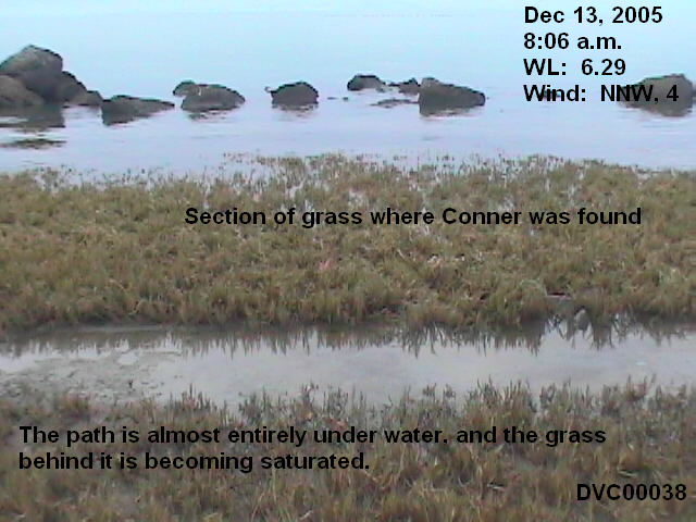
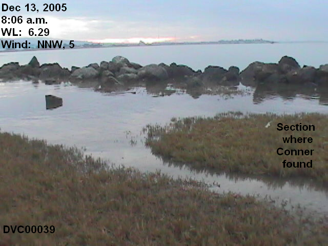
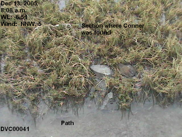
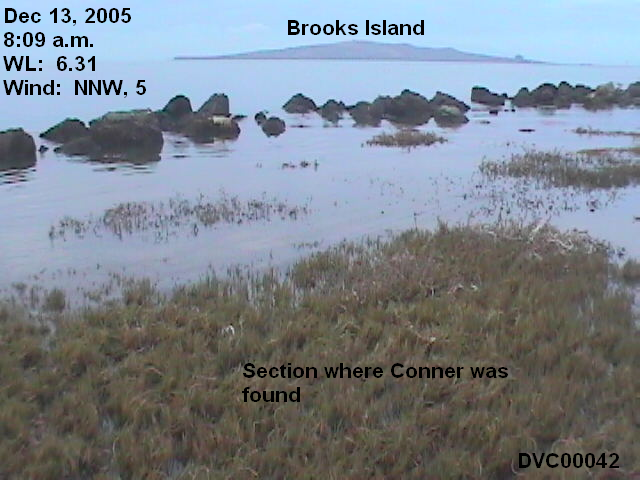
8:06-8:12, 6.29-6.34 feet. Video 6: WMP RM
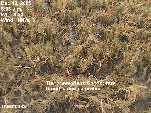
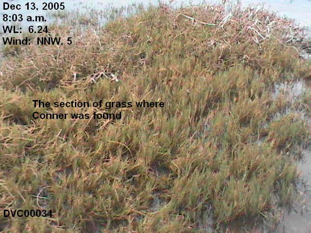
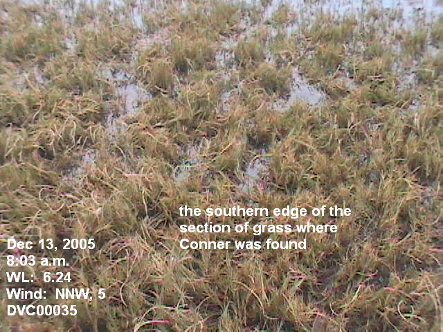
At this point, 8:06 a.m., the water has wrapped around the Conner site, from the East and the West. The front half of the Conner site is now under water. Some rocks in the breakwater are still exposed, but there are large gaps.
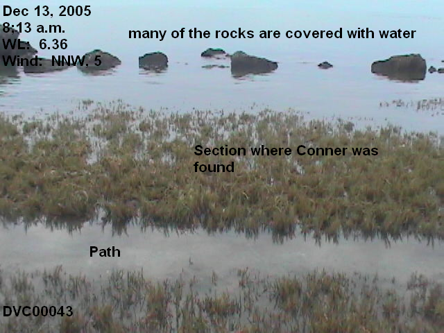
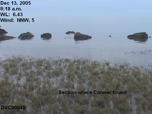
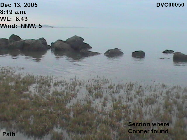
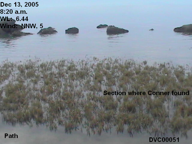
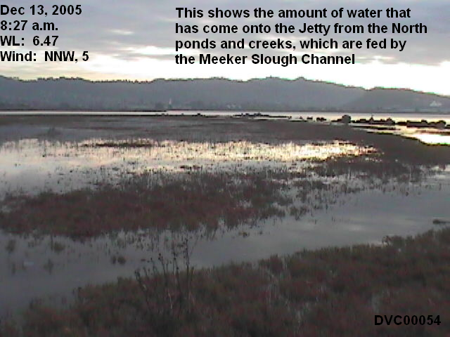
8:12-8:18, 6.34-6.43 feet. Video 7: WMP RM. In this video, I show how much water is coming in from the North.
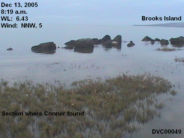
8:18-8:24, 6.43-6.47 feet. Video 8: WMP RM. This video shows the increase in the waves on the Jetty. This is not because the wind has picked up, though there is more of a breeze, but because so much water is flowing over the rocks. I am standing in about 3 inches of water behind the Conner site when I vacate, and walking off the Jetty I had to walk through water up to 6 inches deep.
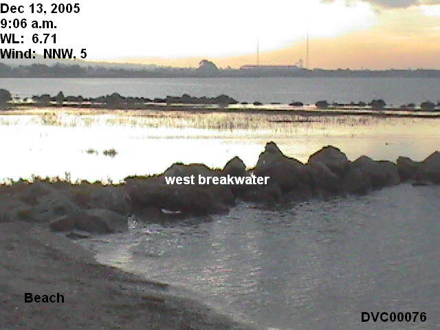
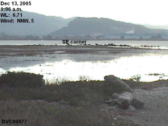
These pictures are taken from the west breakwater.
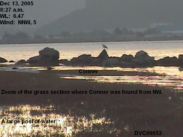
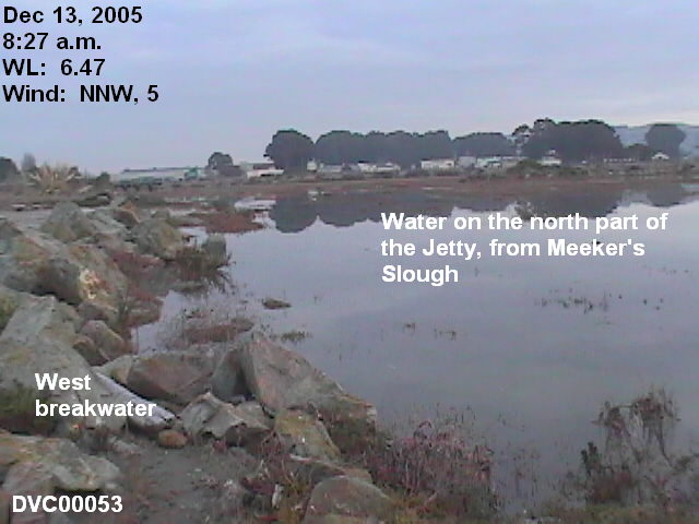
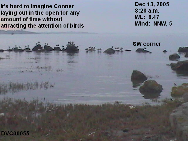
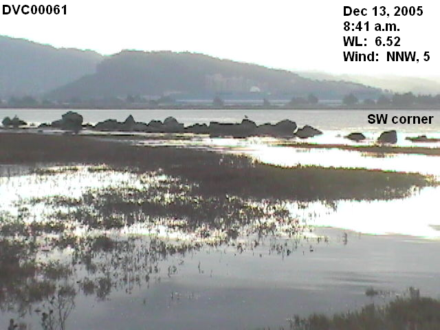
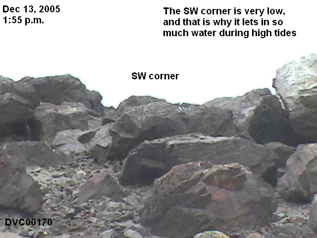
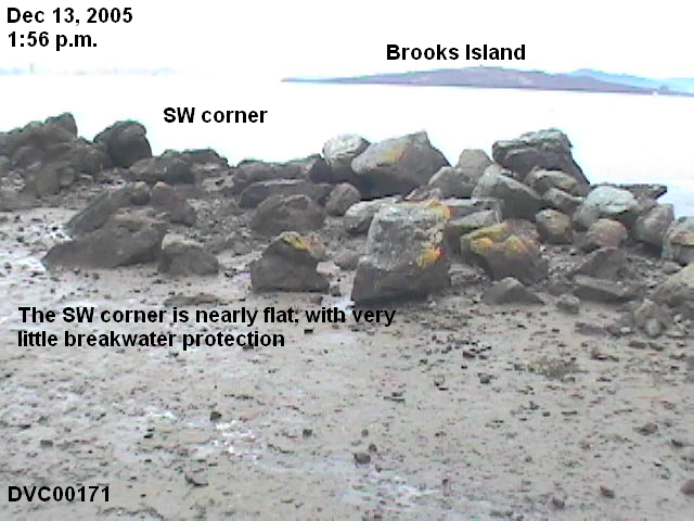
8:24-8:30, 6.47 feet. Video 9: WMP RM. The video shows how much more water is coming from the SW corner, and the strength of its current.
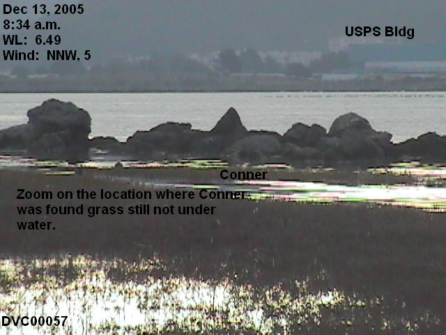
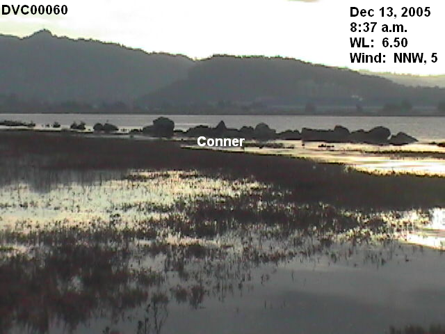
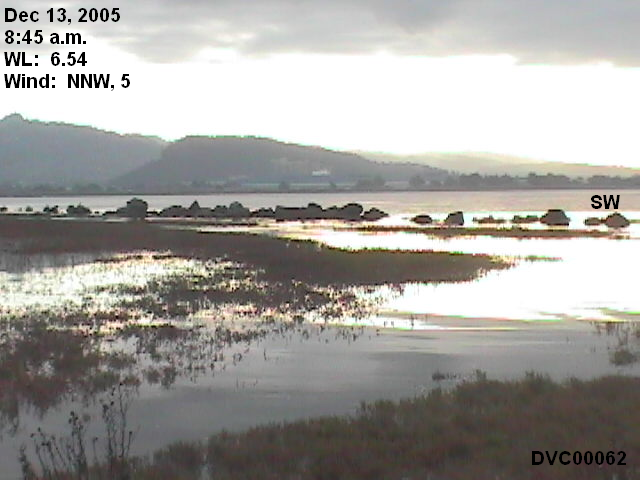
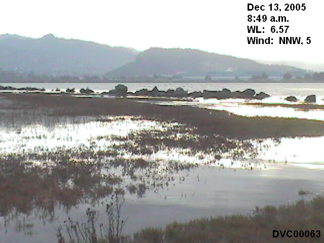
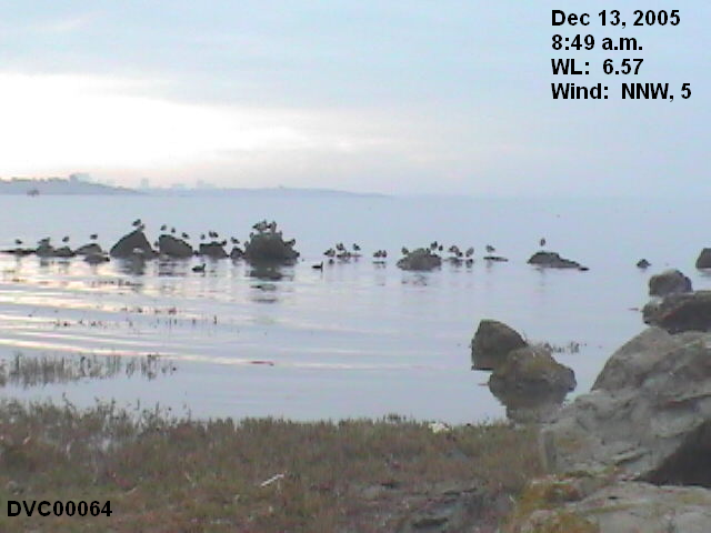
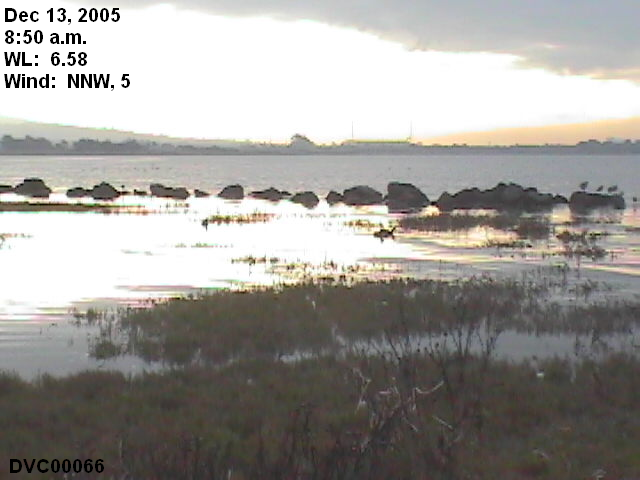
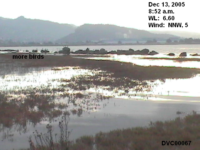
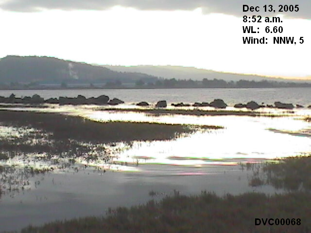
8:36-8:48, 6.50-6.56 feet. Video 10: WMP RM. In these pictures and video, the water definitely appears deeper than in People's 100, and the high tide has not yet peaked.

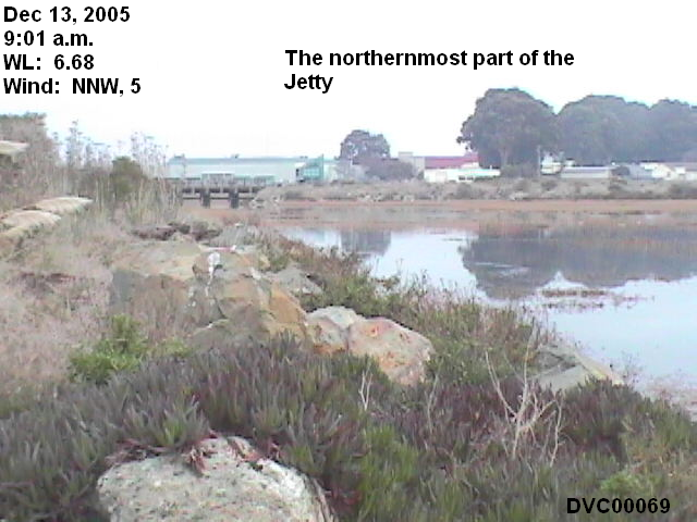
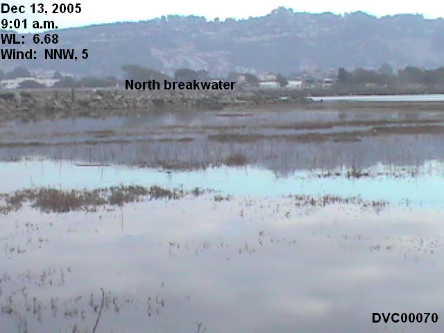
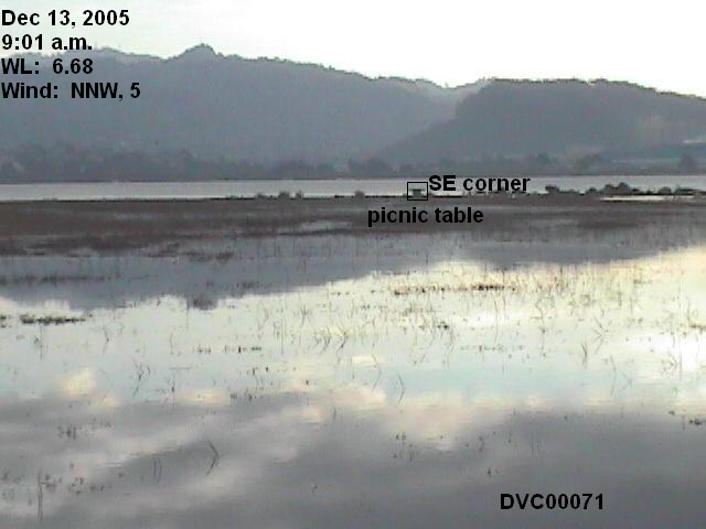
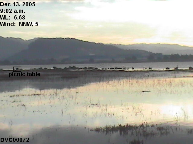
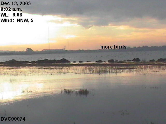
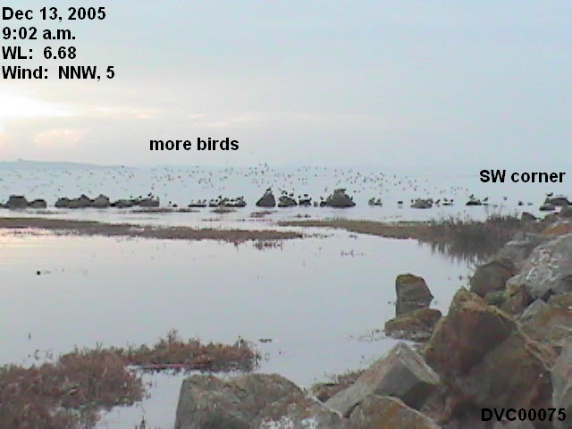
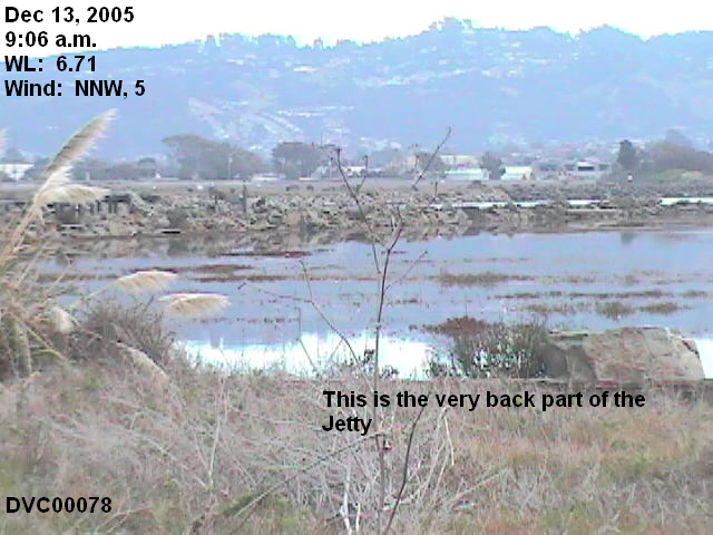
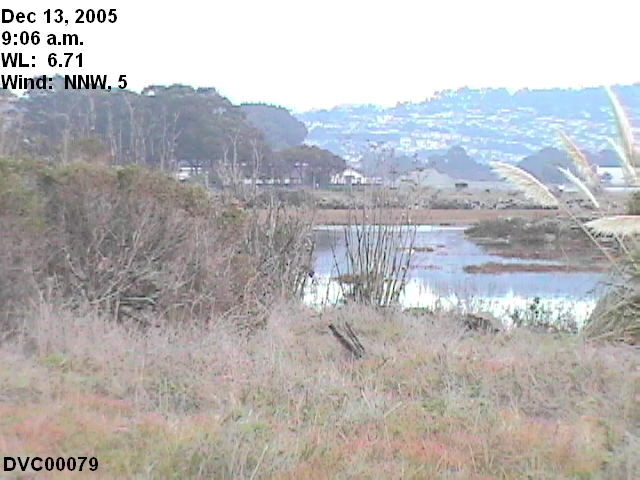
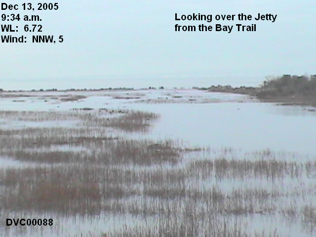
9:00-9:06, 6.67-6.71 feet. Video 11: WMP RM

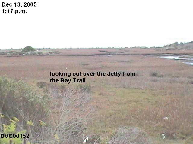
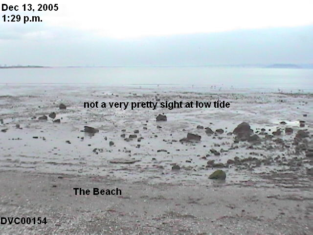
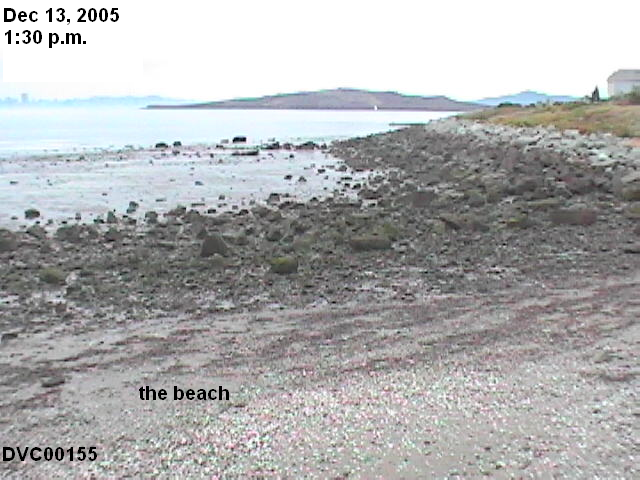
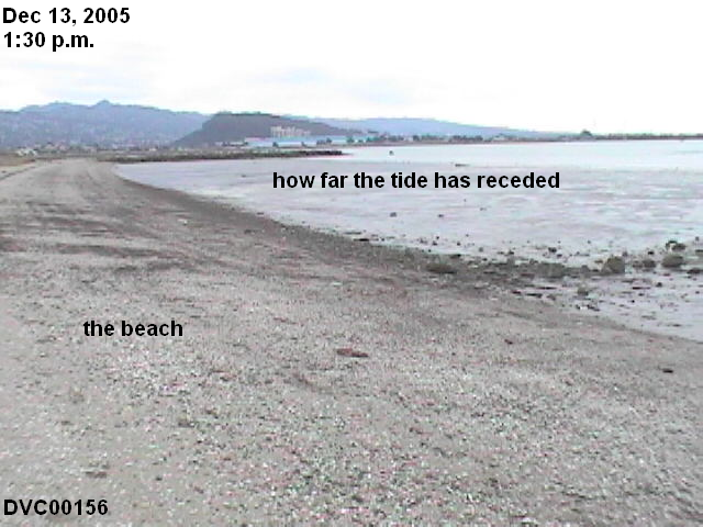
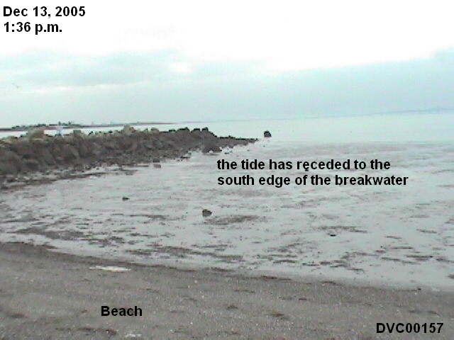
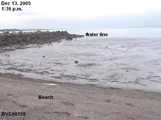
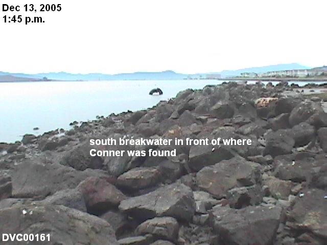
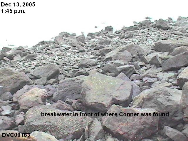
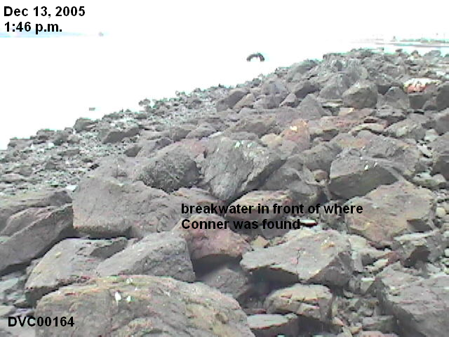
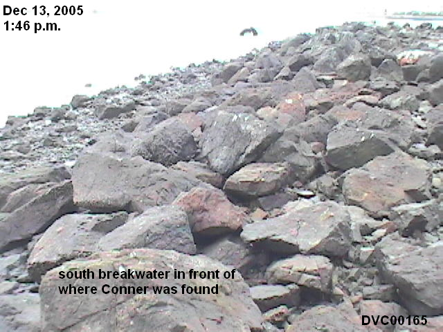
The low tide in the afternoon
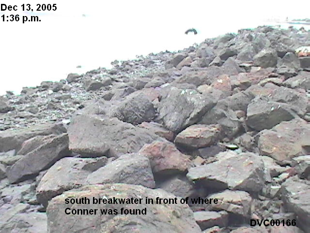
I went back to the Jetty in the afternoon, to see the Jetty at a very low tide.

Video (WMP RM), provides close-ups of the rock breakwater just in front of the Conner site. NOTE: On the video clip, I mistakenly say this is the way the rocks look at "high tide." That, obviously, should be, "low tide."

Conclusion
Since the average of all higher high tides is only 6.05 feet, and the Jetty does not fill with water until the tide reaches about 6.34 feet, we conclude that Rick Distaso blatantly misled the Jury, and the American people, into believing that the Jetty fills with water at every high tide.