Richmond Jetty -- December 18, 2005
Purpose: To capture on film a storm equivalent to the storm on April 12, 2003, and thus see firsthand the effects a storm has on the dynamics of the Jetty.
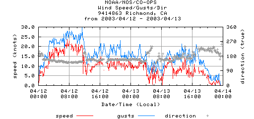
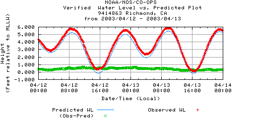
On April 12, the tide peaked at 9:00 a.m. during strong winds. This is the wind and tide data from the NOAA for the Richmond station. The tide peaked at 8:24 a.m. at a water level of 5.77 feet.
Unfortunately, meteorological data for the Richmond station is not available for December 18, 2005. In order to make a valid comparison of the wind, we must compare the data for the same station. The UC Richmond site is very close to the Richmond Jetty, even closer than the NOAA Richmond station, and it has verified data for both April 12, 2003 and December 18, 2005. The heavy green line on each chart indicates the hour ending closest to the peak of high tide. The data for April 12 must be adjust by one hour for DST.
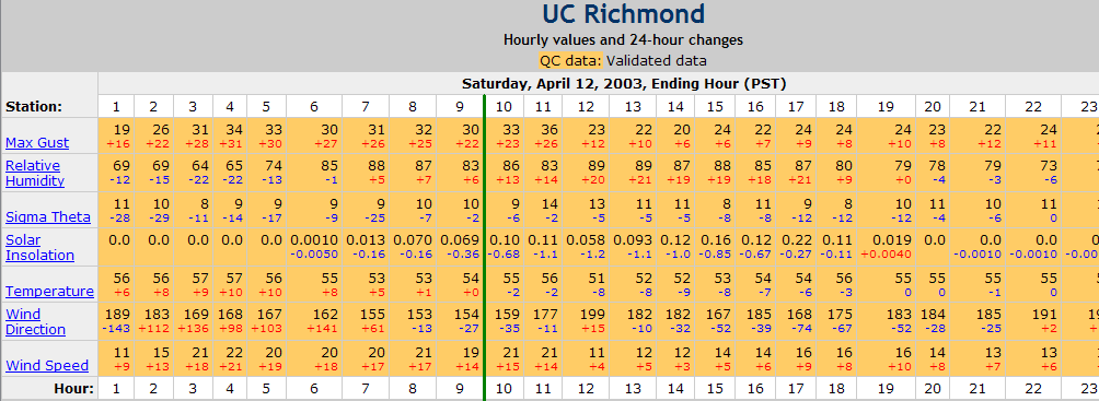
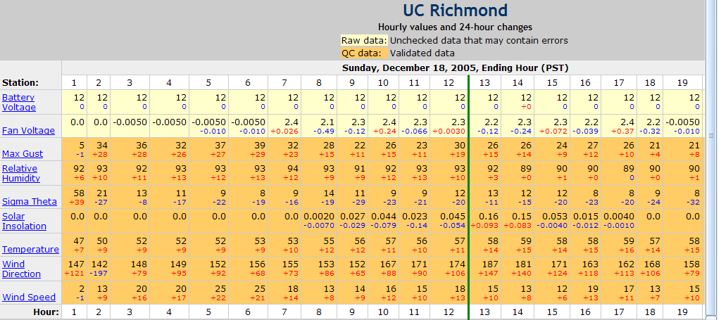
The winds preceding the peak of the high tide on the April 12 were stronger than on December 18, but at the peak high tide, they are almost identical.
The NOAA predicted the water level would reach 6.0 feet at peak high tide. With all of the rain received on the preceding days, the water level was much higher. Unfortunately, the Richmond Station was still not in operation, so I again had to rely on converting the verified water levels from the San Francisco station, which is the reference used by the NOAA to make the predictions for the Richmond station (Corrections Applied: Times: High +0 hr. 24 min., Low +0 hr. 38 min., Heights: High *1.04, Low *0.98). The NOAA predicted a high tide of 5.84 for the San Francisco station (12:15 p.m.) and 6.0 feet (12:39 p.m.) for the Richmond station (2005 predictions).
Because of the heavy rains, the water level on December 18 was considerably higher than predicted. For the San Francisco station, it peaked at 6.79 feet at 12:06 p.m. That's almost 11 1/2 inches above predicted. For the Richmond station, 6.79 converts to 7.06 feet.
I arrived too late to capture the storm at 5.77 feet water level. I started filming at 10:42 a.m., and the water level was already at 6.26 feet above MLLW. I had to make my way very carefully to get to the area to film because of the water already on the Jetty. Once on the Jetty, I was only able to film about 10 minutes before the water became too deep, and was still rising, to have good prospects of being able to get off the Jetty. Once safely at the NW corner, I continued to film. I regret not being able to stay long enough to see the water recede as the tide went out and the storm stopped, but I was drenched, my camcorder bag was drenched, and I could no longer keep the camcorder dry.
Things to Note
1. How long it is before the current from the water on the Jetty moves the debris in the grassy area where Conner was found. I don't make mention of this as I'm filming, but it's a very interesting detail.
2. How the waves beat against the rocks, even as the water level increases. You will see this even in the distance shots, from the white spray they create as they hit.
3. How a floating object is moved by the waves. The footage contains 2 separate examples (# and #12).
I have created files in RealMedia format and Windows Media format. If you have dial-up, use the RealMedia, as they are much smaller. Click here to download a free RealMedia clone if you don't already have RealMedia.
| On the Jetty -- 10:42 a.m. to 10:49 a.m.; VWL: 6.26-6.29 feet above MLLW | |||
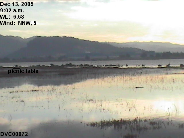
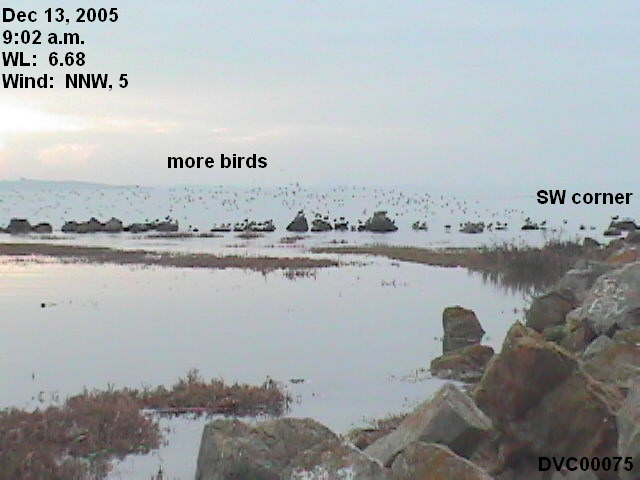
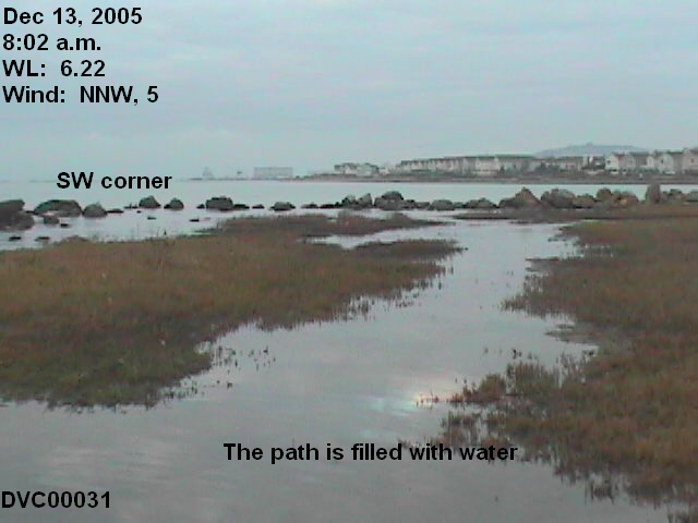
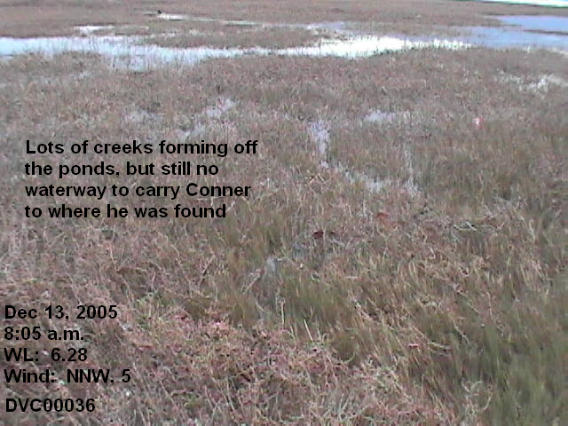
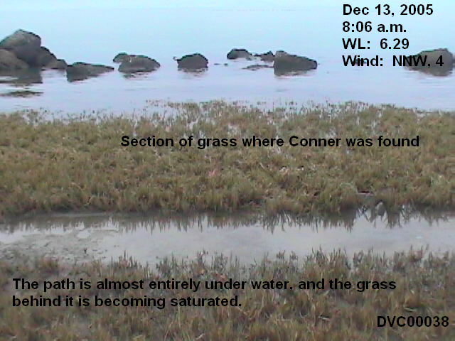
Here are some pictures from the December 13 field trip, at a water level near 6.26-6.29 feet
|
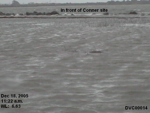
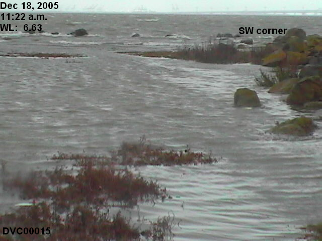
From the NW corner -- 11:07 a.m. to 12:14 p.m. ; VWL: 6.49-6.95 feet above MLLW |
|
9 WinMedia |
|||
|
|
|
|
The first two pictures were taken at 11:22 a.m., at a water level of 6.63, compared to pictures taken on December 13 at comparable water levels.